Hayden Hill

Technical Documentation

NI 43-101 Technical Report

Review the independent NI 43-101 technical report for the Hayden Hill Gold-Silver Project. Join our mailing list and we’ll send a copy straight to your inbox.

Project History

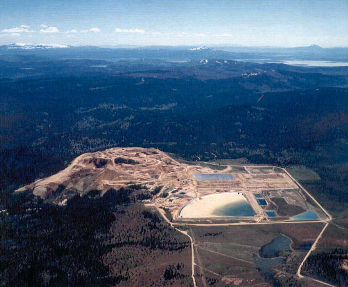
  • Amax Gold Inc., a subsidiary of Amax Inc., bulk mined Hayden based on a shallow, disseminated mineralization model.
  • Historic drilling was limited in scope and depth: 742 holes (327,514 ft), avg. only 441 ft (<150m).
  • Approximately 480,000 ozs of gold and 1.3 million ozs of silver were recovered.
  • Amax Inc. merged with Cyprus in the mid-1990’s which led to the shutdown of Hayden’s operations to focus on copper and molybdenum projects.
  • Kinross acquired Amax Gold in 1998 for three properties — two to develop and one to mine. Kinross did not re-initiate mining or further explore Hayden.
Project Highlights

  • Hayden has not been drill-explored for 29 years.
  • During this period, exploration techniques and understanding of the low-sulfidation epithermal deposit model have significantly evolved.
  • The Four Nines geological team, through three-dimensional modelling of all available data, has determined that Hayden gold mineralization is structurally controlled and interpreted to be hosted in vein structures exposed at surface to continue at depth.
  • The core of the Hayden Hill property is composed of private lands.

3D Modelling

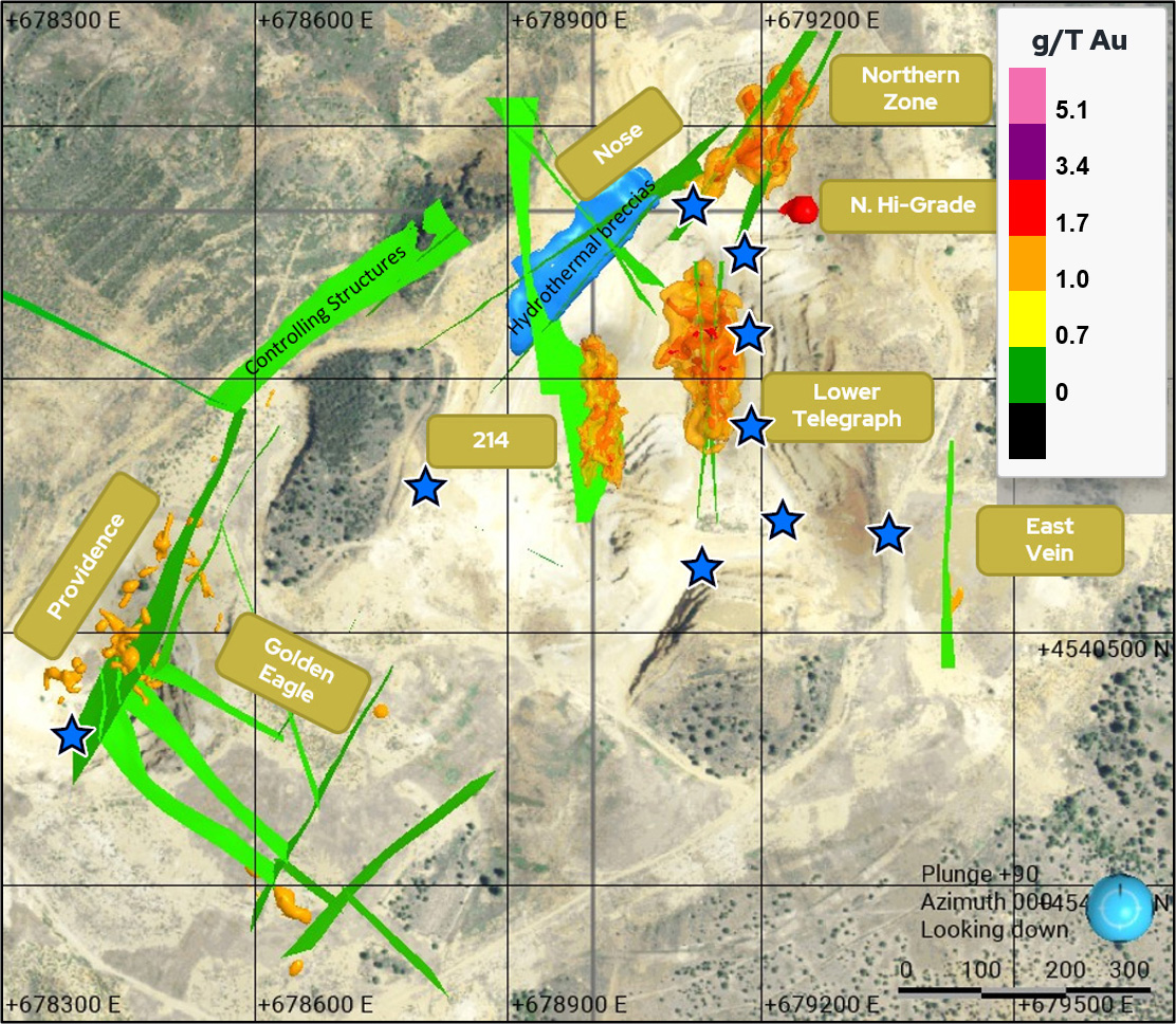
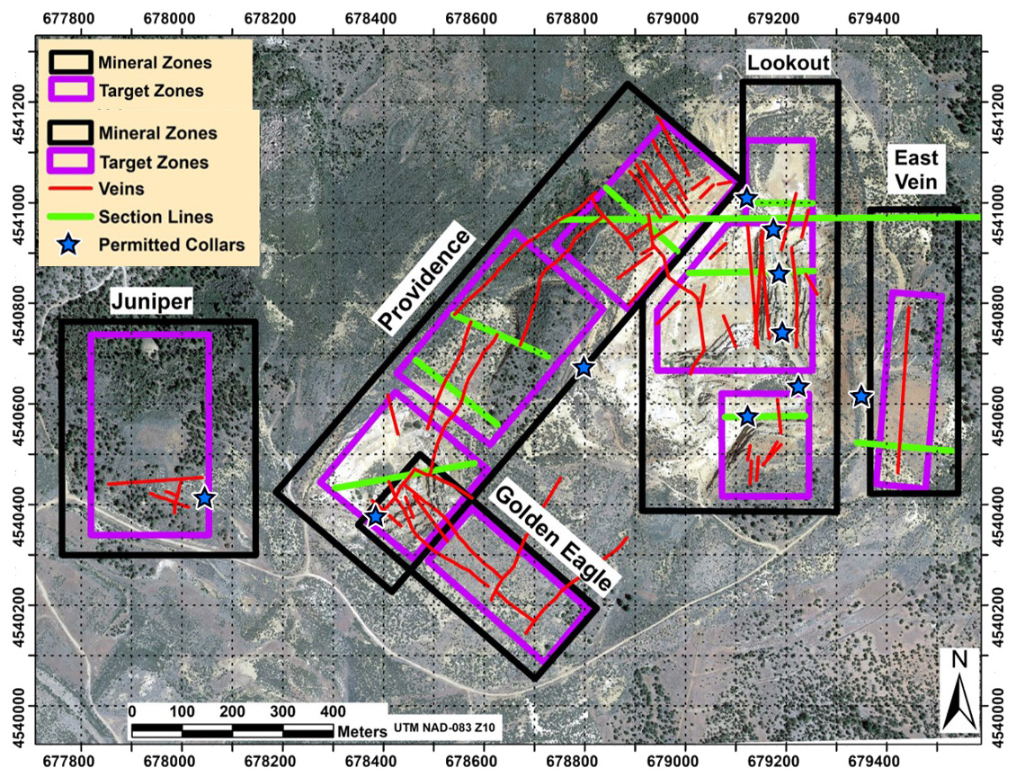
Four Nines has conducted comprehensive three-dimensional modelling of all available data sets for Hayden Hill:

  • High-grade gold mineralization occurs in structures that extend beneath and peripheral to where Amax mined gold.
  • The objective of 3D modelling was to determine the specific location of the gold mineralization mined by Amax.
  • Orange grade shells represent historically mined mineralization.
  • Mapped vein structures (green) are interpreted to be at the core of all high-grade gold zones.
  • The drill-defined high-grade gold target is shown in red.
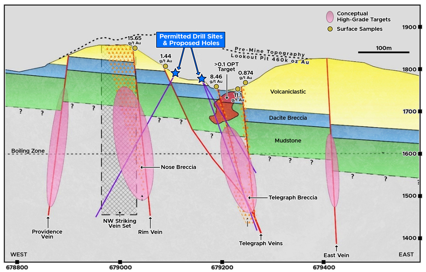
  • The approved drill stations are positioned to target multiple untested high-grade gold structural corridors and deeper vein extensions below where Amax mined gold.

The Plan

  • Opportunity: Our expert geological team has applied an advanced understanding of Hayden Hill geology, and the low-sulfidation epithermal deposit model, to identify significant potential of undeveloped gold and silver mineralization.
  • Objective: Drill to confirm a data-driven understanding of significant mineralization below and peripheral to where gold was mined and revive a past-producing gold and silver mine.
  • Approval:  10 sites at < 1 acre total new disturbance for up to 25,000 feet of core drilling.
  • Drillhole Plan:   Drilling will target data-defined and modelled higher-grade mineralization, focusing on key structural corridors and deeper vein extensions.
  • Environmental Considerations:   Maximize current infrastructure and minimize new disturbances.

LOOKOUT PIT

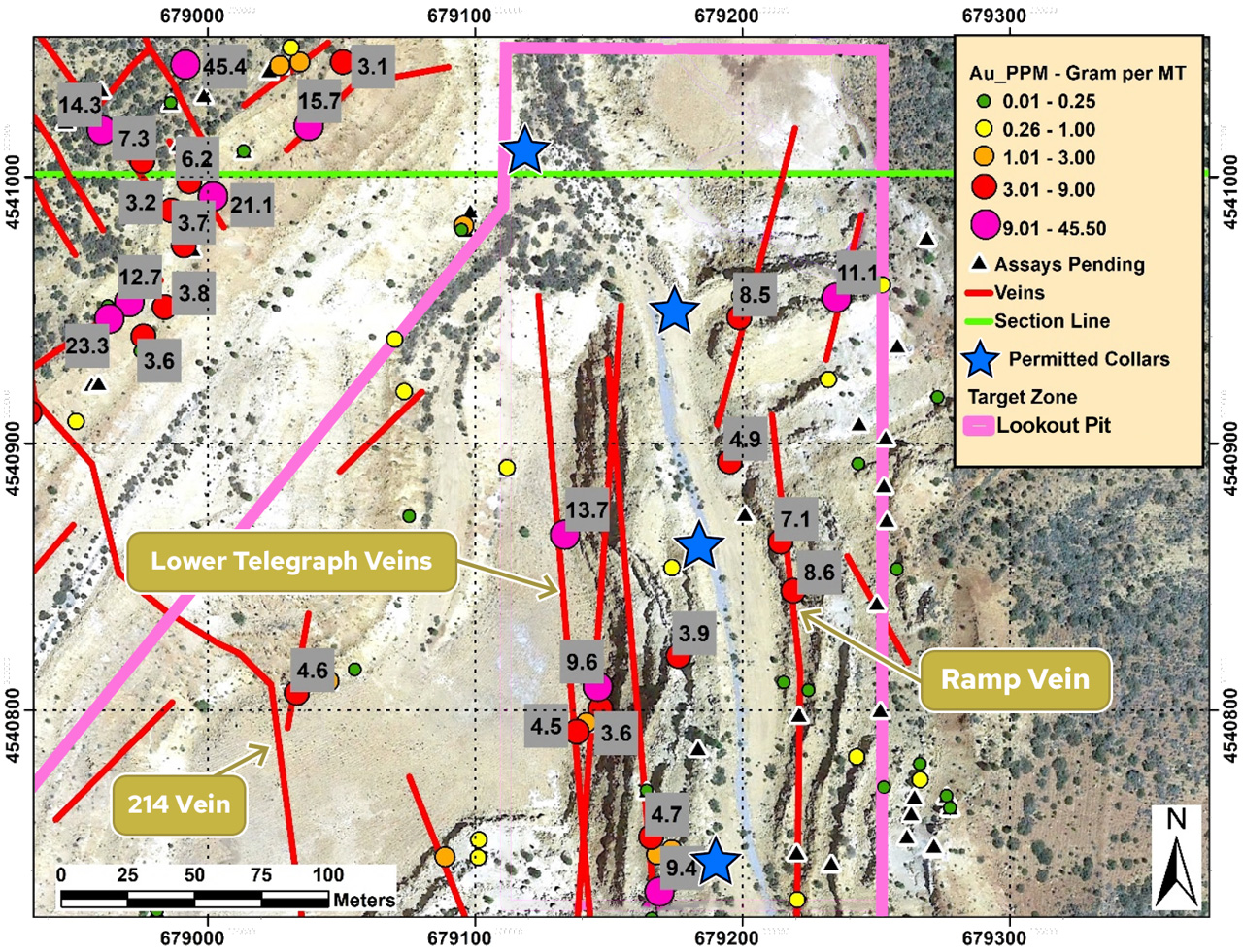
  • Significant pit production by Amax
  • Multiple discrete mineralized veins (red)
  • Multiple exploration holes with intact mineralized intercepts
  • Excellent access on historical ramp
  • Multiple permitted drill sites

Targets

  • Historical drilling with high-grade intercepts
  • Northerly trending structures to depth and breccia bodies

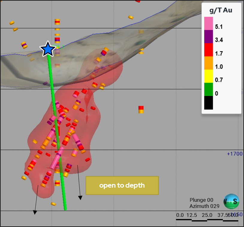
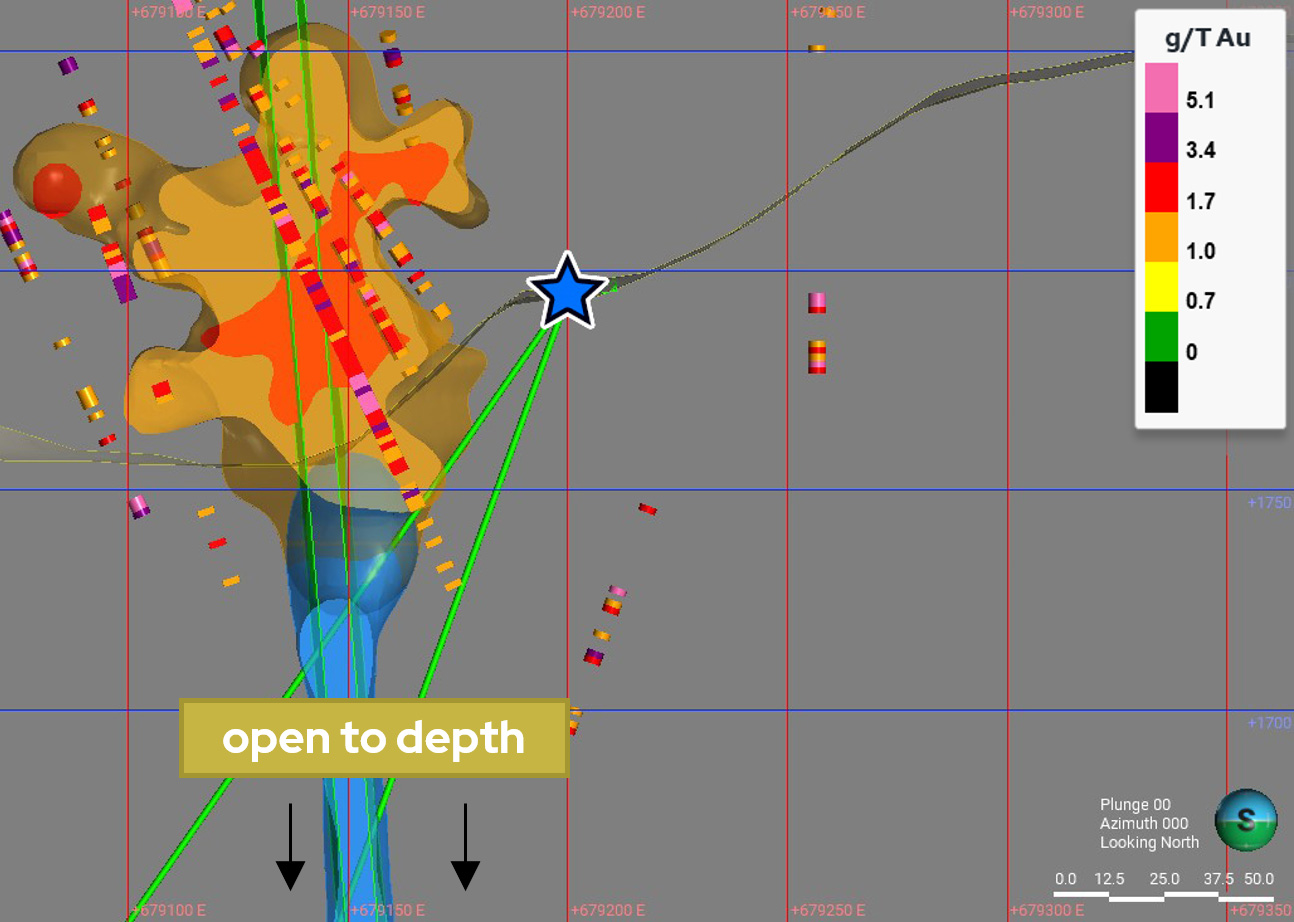
NORTHERN HIGH-GRADE TARGET

  • High-quality, high-probability drill target
  • Multiple historical exploration holes indicate strong targets beneath the current pit
  • Proposed drill hole indicated in green
  • Open to depth

Targets

  • Northerly trending veins
  • Drill-indicated mineralization beneath the pit
  • High-grade

LOWER TELEGRAPH TARGET

  • High-quality, data driven drill target beneath historical pit wall
  • Drill targets are deeper extensions of the controlling veins and breccia
  • Proposed drill hole shown by green line

Targets

  • Two prominent parallel northerly trending mineralized structures
  • Projected feeder zone at depth (blue)

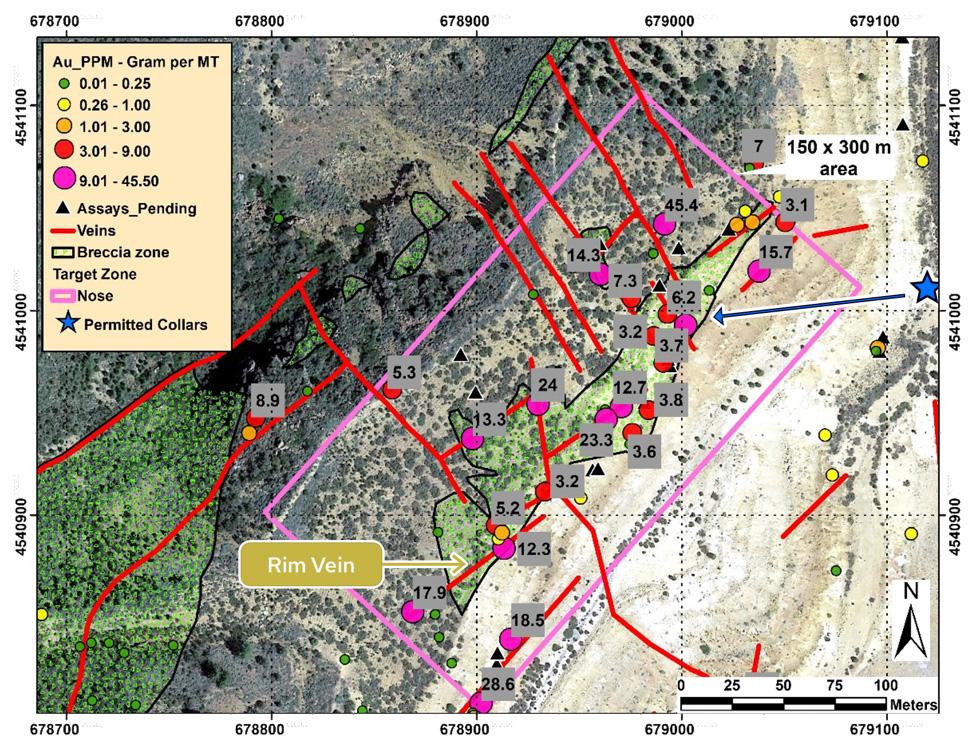
NOSE TARGET

  • Numerous high-grade values from surface samples, with the highest being 45.4 g/t Au.
  • The Nose Zone can be drill-explored, at depth, from a location at the bottom of the Lookout Pit (blue star)
  • Historical exploration of mineralized intervals correlates well to the modelled vein surfaces
  • Main NE trending vein set intersected by NW trending veins
  • Hydrothermal breccia bodies (blue) along, and at the intersection of, veins
  • Permitted drill site set to explore at depth

Targets

  • NE trending veins to depth
  • NE-NW vein intersections to depth
  • Hydrothermal breccia bodies
Stay Informed

Join Our Mailing List

Receive news releases and investor materials directly to your inbox. Your email will never be shared or sold.